Facilitadores impulsan la ganadería sostenible mediante el uso de drones en Honduras
- Capacitación técnica fortalece el monitoreo de fincas y promueve una producción ganadera más eficiente y baja en carbono.
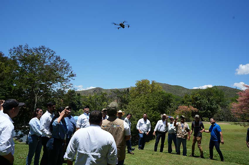
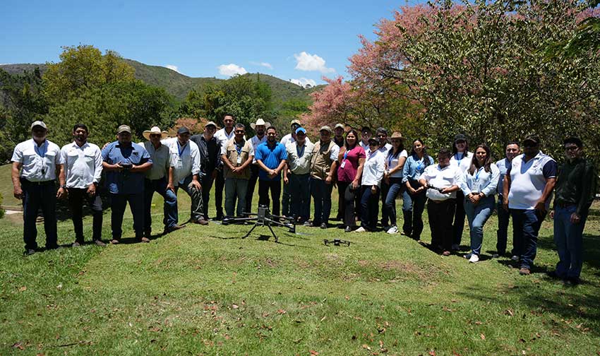
En un contexto donde la innovación tecnológica es clave para enfrentar los desafíos del sector agropecuario, el proyecto Transformando el sector ganadero hondureño en una economía baja en carbono (MAF-Ganadería-HN) da un paso firme hacia la modernización del monitoreo productivo. A través de un taller especializado, donde las personas facilitadoras fortalecieron sus capacidades en el uso de drones (UAV), incorporando herramientas de vanguardia para mejorar la gestión de fincas ganaderas. Esta iniciativa busca acelerar la transición hacia una ganadería más eficiente, resiliente y baja en carbono en el país.
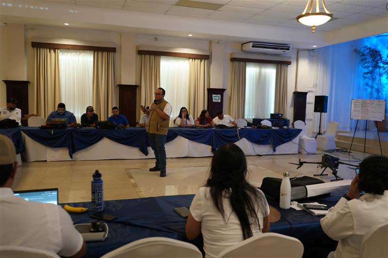
En los últimos años, el uso de vehículos aéreos no tripulados (drones) ha crecido significativamente gracias a su versatilidad, facilidad de transporte y capacidad para generar información precisa. Sin embargo, en el sector ganadero de Honduras, uno de los principales desafíos ha sido la limitada disponibilidad de información y herramientas tecnológicas que permitan monitorear las fincas de manera efectiva. Esta brecha dificulta la evaluación de cambios en el uso y cobertura del suelo, así como la implementación de prácticas sostenibles, fundamentales para avanzar hacia una producción baja en carbono.
Frente a este reto, el proyecto MAF-Ganadería-HN ha promovido la incorporación de tecnologías innovadoras como los drones, con el objetivo de fortalecer las capacidades técnicas de las personas facilitadoras y actores locales. Como parte de esta estrategia, se desarrolló un taller práctico en el que los participantes adquirieron conocimientos sobre conceptos fundamentales de UAV, su clasificación (multirotor y ala fija), tipos de sensores (RGB, multiespectral y LiDAR), así como pilotaje y planificación de misiones de vuelo.
En este proceso de innovación, destaca de manera particular la incorporación de tecnología LiDAR montada en drones, una aplicación aún incipiente en Honduras y prácticamente inexistente en el sector ganadero del país. Este enfoque representa un salto cualitativo en la forma de monitorear los sistemas productivos, ya que permite capturar información tridimensional de alta precisión sobre la estructura de la vegetación. A diferencia de otros sensores, el LiDAR posibilita estimar de manera directa variables clave como la altura y densidad de la biomasa, lo que abre nuevas oportunidades para entender la dinámica de los sistemas silvopastoriles y su contribución a la captura de carbono.
El proyecto MAF-Ganadería-HN está apostando por el desarrollo de protocolos técnicos y algoritmos específicos que permitan traducir estos datos en indicadores robustos para el monitoreo de carbono en fincas ganaderas. Este esfuerzo busca no solo generar evidencia científica adaptada al contexto nacional, sino también sentar las bases para la integración de estas tecnologías en sistemas de Monitoreo, Reporte y Verificación. De esta manera, el uso de drones LiDAR se posiciona como una herramienta estratégica para fortalecer la medición de co-beneficios ambientales, mejorar la toma de decisiones en finca y avanzar hacia una ganadería más eficiente, resiliente y alineada con los compromisos climáticos del país.
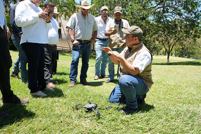
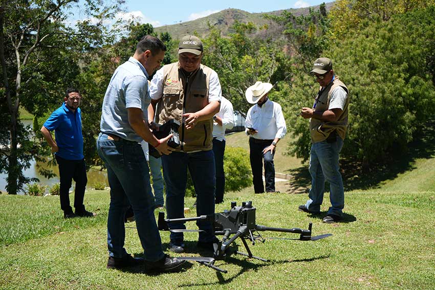
Además, el proceso incluyó entrenamiento práctico en campo para la operación segura de drones y el uso de herramientas de fotogrametría y sistemas de información geográfica (SIG), facilitando la captura, procesamiento y análisis de información geoespacial aplicada a sistemas productivos.
Como resultado, las personas facilitadoras fortalecieron sus habilidades técnicas para el monitoreo de fincas ganaderas, mejorando la calidad de la información disponible para la toma de decisiones. Esta iniciativa contribuye a promover una ganadería más productiva, sostenible y resiliente, mediante el uso de tecnologías que permiten evaluar de manera cuantitativa y cualitativa los cambios en el territorio.
Key Achievements and Highlights
- Facilitadores capacitados en la planificación de misiones de vuelo (rutas, solapes y resolución espacial – GSD).
- Conocimientos en el uso de sensores (RGB y multiespectral) aplicados al monitoreo productivo.
- Capacidades básicas en procesamiento de imágenes mediante fotogrametría (ortomosaicos, DSM y DTM).
- Habilidades para interpretar información geoespacial y apoyar la toma de decisiones en campo.
- Conocimientos en protocolos de seguridad y buenas prácticas para la operación de drones.
- Fortalecimiento en el monitoreo ambiental y productivo en fincas ganaderas.
- Capacidades para replicar conocimientos en sus territorios.
- Comprensión del flujo completo: planificación, captura, procesamiento e integración en SIG.
- Sensibilización sobre el uso de tecnologías digitales para una ganadería sostenible y baja en carbono.
“Este tipo de capacitaciones nos permite ver nuestras fincas desde otra perspectiva, con información más precisa que nos ayuda a tomar mejores decisiones”, destacó Keny Cardona, facilitador participante del taller.
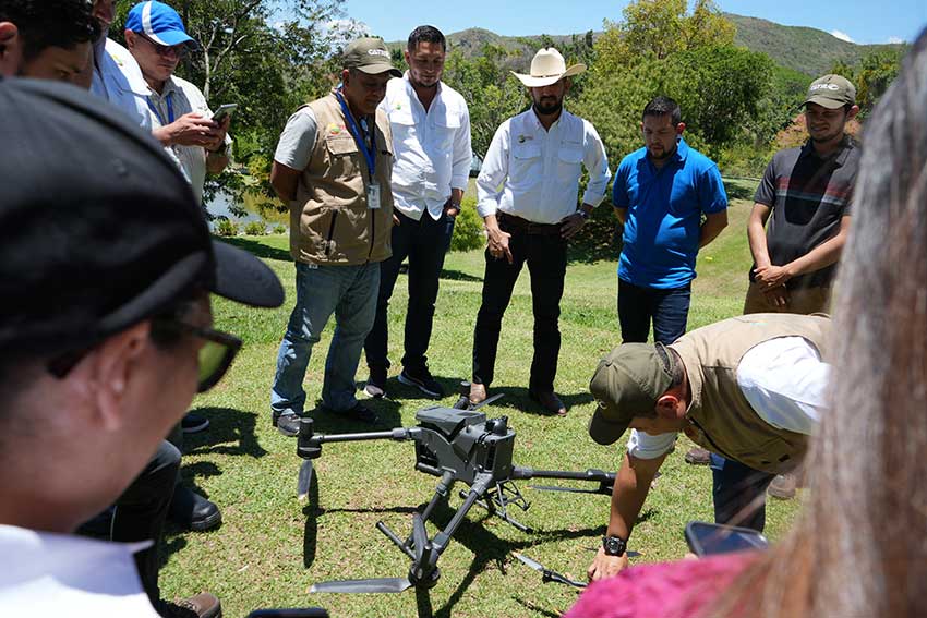
“Los drones representan una herramienta clave para modernizar la ganadería y hacerla sostenible, especialmente en el monitoreo de cambio de usos y coberturas de suelo y la implementación de buenas prácticas”, señaló Jeffrey Díaz, especialista SIG del proyecto MAF-Ganadería-HN.
El fortalecimiento de capacidades en el uso de drones marca un avance significativo en la transformación del sector ganadero en Honduras. A través del proyecto MAF-Ganadería-HN, se continúa impulsando la adopción de tecnologías innovadoras que contribuyen a mejorar la productividad, reducir el impacto ambiental y avanzar hacia una economía baja en carbono.
Durante los próximos años, el proyecto seguirá promoviendo soluciones tecnológicas que fortalezcan las capacidades locales y amplíen su impacto en los territorios, facilitando una ganadería más sostenible, resiliente y alineada con los desafíos climáticos actuales.
More information:
Juan Carlos Flores
National Coordinator Honduras
Transforming the Honduran Livestock Sector into a Low-Carbon Economy (MAF-Ganadería-HN).
CATIE
juan.flores@catie.ac.cr
Written by::
Gina Samanti Puerto Morazán
Communicator
Transforming the Honduran Livestock Sector into a Low-Carbon Economy (MAF-Ganadería-HN).
CATIE
gina.puerto@catie.ac.cr